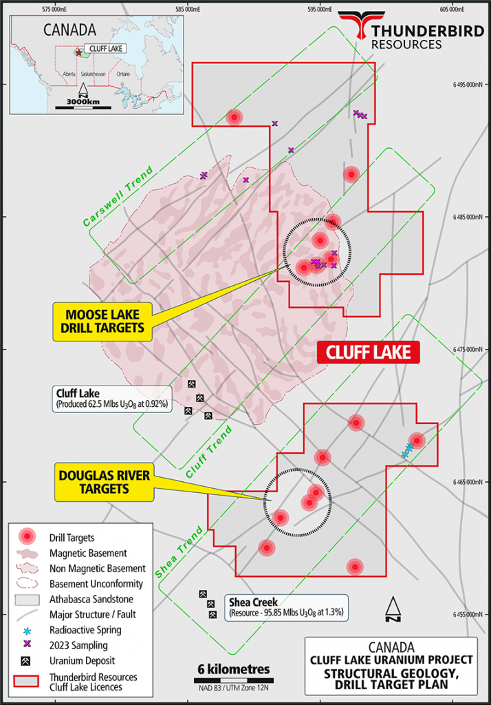
332km2 landholding located 7km east of the Cluff Lake Mine which produced 62Mlb U3O8 at an average grade of 0.92% U3O8 and 2.5km northeast of UEX/Orano’s Shea Creek uranium deposit.
Potential for Basement-hosted and Unconformity-type uranium deposits.
The nearby Cluff Lake mine is a mainly basement hosted deposit comprised of four open pits and two underground mines.
Three NE-SW trending structural corridors identified, reflecting potential deep-seated basement structures with targets along trend from Cluff Lake Mine and Shea Creek deposit.
Two areas (Moose Lake and Douglas River) proposed for drill testing.
Three drill targets defined ~15km north-east of Cluff Lake Mine – Moose Lake area, with basement-hosted targets and assays of up to 9.15% TREO.
Another group of targets defined around 10km north-east of Shea Creek deposit and 10km southeast of Cluff Lake Mine – Douglas River area
Basement-hosted and unconformity-style targets at Douglas River with depth to basement interpreted as 100-200m near drill targets and MEGATEM conductors identified within basement.